


Exhibitors③
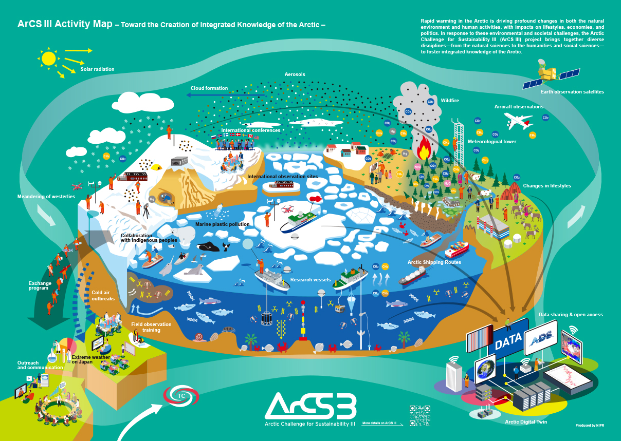
Arctic Challenge for Sustainability III (ArCS III)
Arctic Challenge for Sustainability III (ArCS III)

| Address | 190-8518 10-3 Midori-machi, Tachikawa-shi, Tokyo, Japan |
|---|---|
| Web site, SNS | https://www.arcs3.nipr.ac.jp/en/ |
Department of Earth and Planetary Science, The University of Tokyo
Department of Earth and Planetary Science, The University of Tokyo
Contents
Contents
Download
Contents
①× ×, 2021(×)13:00~14:00
②× ×, 2021(×)13:00~14:00
Please click here to contact us (Zoom will start)
Earth, Planets and Space
Earth, Planets and Space

publishing with Springer-Nature
Impact Factor (2024): 2.5
5-year IF (2024): 2.8
CiteScore: 5.8
H Index: 91
Rapid peer review and publication
15 days submission to first editorial decision for all manuscripts (Median)
Article Type
Full Paper without word limit.
Express Letter has a limit of 5000 words including the main text, figure legends and table legends. The sum of the number of figures and tables should be less than or equal to 5.
Frontier Letter can be submitted upon invitation by the Editor-in-Chief.
Technical Report describes the technical development of instrument or software.
Comment is a substantial re-analysis of a previously published article in the journal.
“Express Letter”
Express Letters provide you with a fast turnaround time, while maintaining rigorous peer review.
From submission to first decision, the shortest time is 19 days, and the average is 45 days (based on 2023 data).
"Technical Report"
Technical Reports present a software tool or an experimental or computational method, test or procedure, or hardware design.
Special Issues
We welcome proposals for special issues.
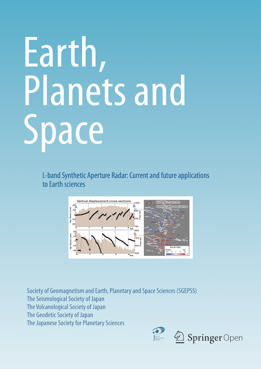
Submit your paper to journal EPS
Article Processing Charge
Full Paper/Technical Report €1370.00 EUR
--- Members* of the societies co-publishing EPS will obtain discounts.
Express Letter €989.82 EUR
--- This discounted price applies to papers accepted by July 2028.
https://www.earth-planets-space.org/ja/howtosubmit
(*) The APC for members is applicable when a corresponding author belongs to any of the five societies that co-publish EPS.
Editor in Chief
Masahito Nosé
Nagoya City University, Japan
Vice Editors-in-Chief
Takahiro Ohkura Tatsuhiko Saito Hidenori Genda
Advisory Board
Editorial Board

| Address | 650-0034 3F Sannomiya Century Bldg., 83, Kyomachi, Chuo-ku, Kobe, Hyogo |
|---|---|
| TEL | 078-332-3703 |
| Web site, SNS | https://www.earth-planets-space.org/en/ |
Earth-Life Science Institute (ELSI),Institute of Science Tokyo
Earth-Life Science Institute (ELSI),Institute of Science Tokyo
Contents
Contents
Download
Contents
①× ×, 2021(×)13:00~14:00
②× ×, 2021(×)13:00~14:00
Please click here to contact us (Zoom will start)
Field Pro, Inc.
Field Pro, Inc.
Contents
Contents
Download
Contents
①× ×, 2021(×)13:00~14:00
②× ×, 2021(×)13:00~14:00
Please click here to contact us (Zoom will start)
Geodynamics Research Center (GRC), PIAS, Ehime University
Geodynamics Research Center (GRC), PIAS, Ehime University

Geodynamics Research Center (GRC) is an international research institute where researchers conduct leading-edge studies on materials and states of the Earth's deep interior in order to reveal dynamics and evolution of the Earth and planets, based on advanced high-pressure experiments and numerical simulations. We investigate various issues of the Earth and planetary sciences, chemical composition of the Earth's lower mantle, materials and structures of the Earth's core, Earth's deep water, internal structure of solar planets and exoplanets and dynamics of the planetary interior, and expand our techniques and knowledge to a field of material sciences for synthesizing novel useful materials such as the world-hardest material "HIME-Diamond".
The radius of the Earth is about 6,400 km, but only 10 km depth is achieved by drillings. The Earth's deep interior is an unreachable place where pressure and temperature at the center are estimated to be respectively 360 GPa and 5000 K or higher. Thus, high-pressure and temperature experiments and numerical simulations are essential tools to study dynamics and composition under such extreme conditions. Developments of the techiniques at GRC lead to an innovative area of high-pressure materials sciences; syntheses of newly novel materials which are obtainable only by high pressure experiments.
◆PRIUS: Premier Research Institute for Ultrahigh-pressure Sciences
GRC operates PRIUS from 2013 which is one of the "Joint Usage / Research Centers" in Japan authorized by the Ministry of Education, Culture, Sports, Science and Technology. Missions of PRIUS, as an international education and research hub, are to conduct Earth and planetary science and material science research by using the high-pressure techniques with the objective of creating new fields of science thorough the international collaborations and interdisciplinary networks of researchers.
GRC conducts experiments under conditions of ultra high pressure and high temperature experiments of the Earth's and planetary deep interiors by using two types of high-pressure generationg appaturs: Munti-anvil high-pressure apparatus and Diamond anvil cell apparatua. GRC is equipped with several types of Multi-anvil apparatus, including the world-largest class one of 6000-ton press, BOTCHAN.
◆Phase transitions of minerals
A “phase transition” is characterized by the change of configuration of a toms in mineral by the effect of pressure. Diamond is a high pressure form of graphite, whose phase transition occurs at 5 GPa (150 km depth). Measurements of the conditions where the phase transitions occur and changes of the physical properties of minerals (density, sound velocity, chemical properties etc) accompanying the phase transition bring fruitful information for understandings of the Earth's deep structure and materials.
◆Numeral simulations
Ab initio computations: Theoretical and computational investigation on the
ultrahigh-pressure behaviors of materials in the Earth and planets are conducted by using computer simulations based on quantum mechanics.
Fluid mechanics computation: Numerical simulations based on the fluid and continuum mechanics are conducted to reveal the convective motions in the mantle and core of the Earth and terrestrial planets for the understandings of the dynamics and evolution processes of the planets. Large scale computations using realistic parameters of the Earth, phase transitions, viscosity and compression behaviors under high pressure, are performed for 3-D spherical-geometry simulations.
HIME-Diamond synthesized in GRC is the hardest diamond and likely the hardest material in the world. Unlike normal diamond made of a single
crystal, HIME-Diamond consists of closely-packed nanometer-sized diamonds (~10 nanometers = one hundred-thousandth millimeters). Thus the HIME-Diamond is also called "Nano-polycrystalline diamond (NPD)".
◆Toward higher pressure generations
Experiments under higher pressure are of importance to investigate the interiors of the Earth and planets. The harder the compression material is, the higher the pressure we can reach and thus HIME-Diamond plays a
major role in future development of experiments at ultrahigh pressure. The high transparency of HIME-Diamond enables high-pressure experiments using optical in-situ observations and synchrotron radiations.
◆Novel polycrystalline materials and gems
GRC conducts syntheses of novel polycrystalline materials by applying techniques learned from making of HIME-Diamond. Nano-polycrystalline
stishovite (NPS) made from silica (SiO2) is one of the novel materials synthesized by GRC. NPS shows excellent physical properties having both hardness and toughness. Garnets (one of the main constituents within the Earth) with a variety of chemical compositions can be synthesized as nano-polycrystalline materials.
| Address | 790-8577 2-5 Bunkyo-cho, Matsuyama, Ehime, 790-8577 Japan |
|---|---|
| TEL | 089-927-8165 |
| Web site, SNS | https://www.grc.ehime-u.ac.jp/en |
Geoscience Enterprise (GSE)
Geoscience Enterprise (GSE)
Elastic Multi-parameter FWI & RTM
In-house software dedicated to high-resolution acoustic & elastic depth imaging:


Dedicated Workflow for Geothermal Exploration
Collect and review surface observations and available subsurface data.
Conduct geological and geophysical surveys (MT, seismic, etc.)
Compile multi-disciplinary geophysical, geological, and geochemical information
Target-oriented interpretation
Narrow-down the uncertainties for a better decision-making on drilling
Realtime induced seismicity monitoring
Timelapse reservoir monitoring
How We Work
Example Projects
(1) Integrated MT + Microseismic

(2) Near-surface Characterization

Visit us at Booth A63 for:
| Address | Chuwa Bldg. 4F, 2‑2‑10 Shibakoen, Minato‑ku, Tokyo 105‑0011, Japan |
|---|---|
| TEL | +81 3-6435-2747 |
| Web site, SNS | https://geo-science.co.jp/home-en/ |
Global Antarctic Science
Global Antarctic Science
Contents
Contents
Download
Contents
①× ×, 2021(×)13:00~14:00
②× ×, 2021(×)13:00~14:00
Please click here to contact us (Zoom will start)
Hakusan Corporation
Hakusan Corporation

Contents
Contents
Download
Contents
①× ×, 2021(×)13:00~14:00
②× ×, 2021(×)13:00~14:00
Please click here to contact us (Zoom will start)
| Address | 183-0023 東京都府中市宮町1-40 KDX府中ビル8F |
|---|---|
| TEL | 042-333-0080 |
| Web site, SNS | https://www.hakusan.co.jp/english/ |
Marine Works Japan Ltd.
Marine Works Japan Ltd.

 https://www.mwj.co.jp/service/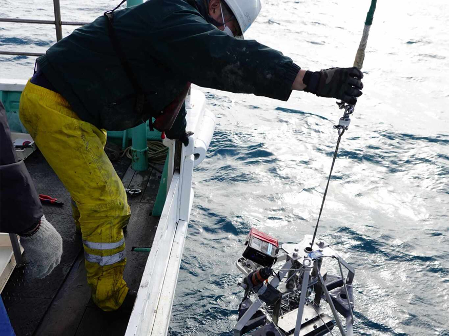
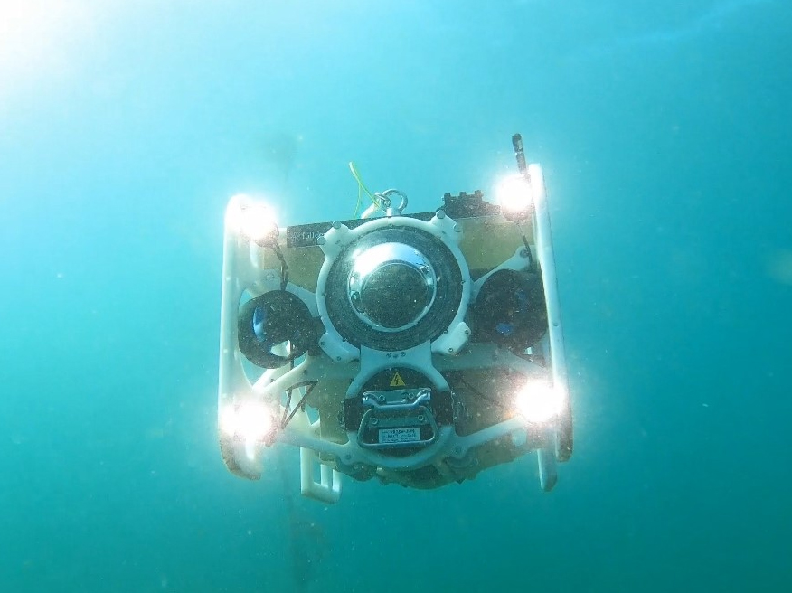
(Left) Sediment sampling (Right) Underwater camera filming
We offer solutions to the challenges faced by clients in various industries, including renewable energy and fisheries. With our extensive experience and expertise in marine research, we are committed to contributing to the success of your business.
https://www.mwj.co.jp/solution/
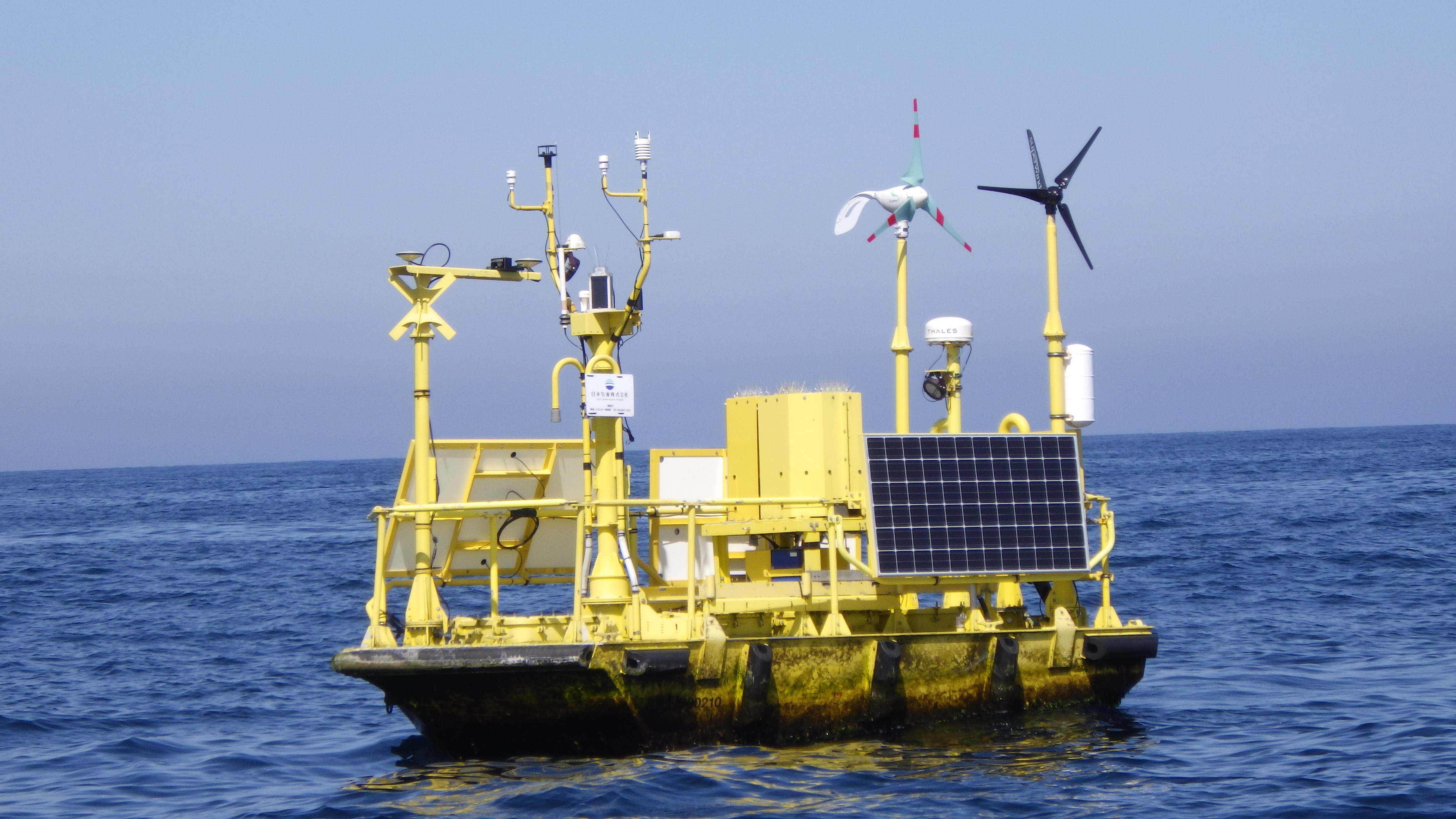
Floating LiDAR
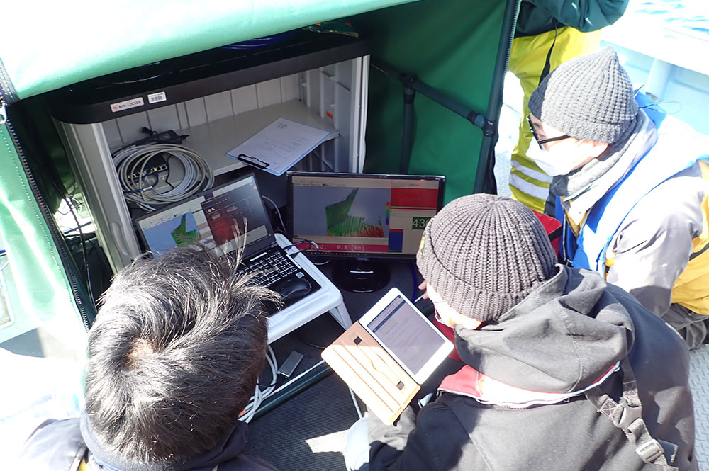
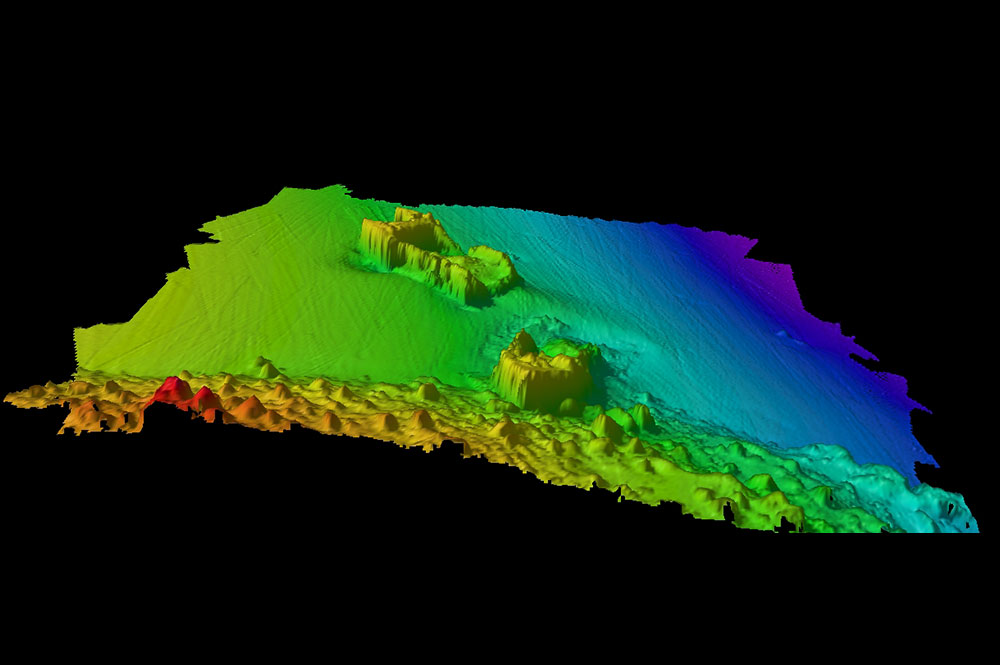
(Left) Bathymetric survey using Multi-Beam Echo Sounder (MBES)
(Right) 3D seafloor mapping
https://www.mwj.co.jp/case/
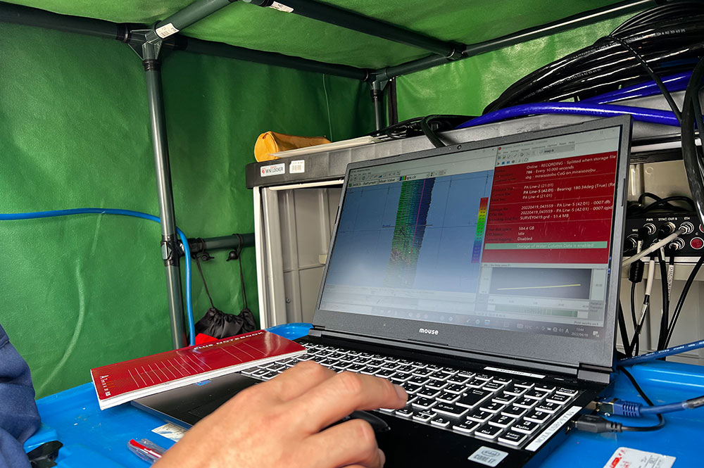
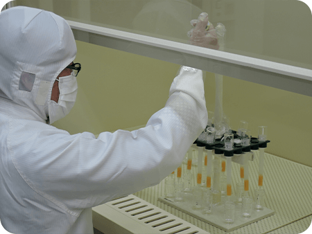
(Left) MBES data recording (Right) Lithium separation process
https://www.mwj.co.jp/catalogue/
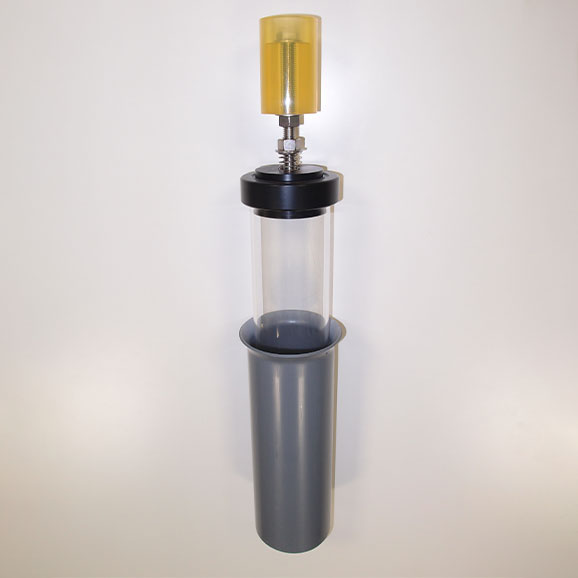
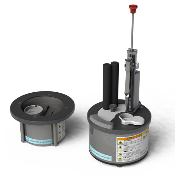
(Left) Columnar sediment sampler (Right) Sandwich freezer
https://www.mwj.co.jp/blog/
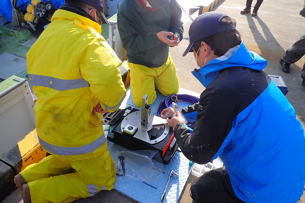
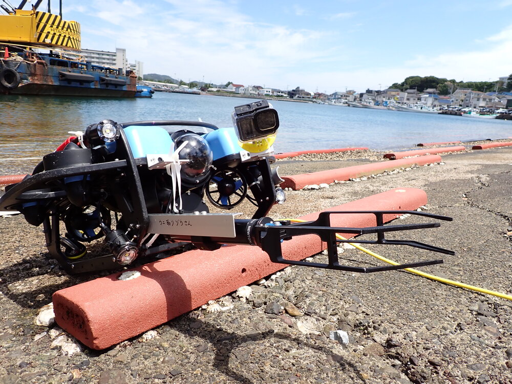
(Left) MBES sonar head assembly
(Right) Development of sea urchin harvesting technology using underwater drones
https://mwj.co.jp/recruit/
New graduate hiring (via mynavi)
https://job.mynavi.jp/27/pc/search/corp109204/outline.html
Mid-career recruitment / Experienced hiring
https://mwj.co.jp/recruit/mid-career/
Employee Interviews
https://mwj.co.jp/recruit/interview-top/
| Address | 237-0063 Marine Works Japan Ltd. |
|---|---|
| Web site, SNS | https://www.mwj.co.jp/ |
Meiwafosis Co., Ltd.
Meiwafosis Co., Ltd.
Contents
Contents
Download
Contents
①× ×, 2021(×)13:00~14:00
②× ×, 2021(×)13:00~14:00
Please click here to contact us (Zoom will start)
Nuclear Waste Management Organization of Japan(NUMO)
Nuclear Waste Management Organization of Japan(NUMO)
Contents
Contents
Download
Contents
①× ×, 2021(×)13:00~14:00
②× ×, 2021(×)13:00~14:00
Please click here to contact us (Zoom will start)
Okamoto Glass Co., Ltd
Okamoto Glass Co., Ltd
Contents
Contents
Download
Contents
①× ×, 2021(×)13:00~14:00
②× ×, 2021(×)13:00~14:00
Please click here to contact us (Zoom will start)
Paleo Labo Co., Ltd.
Paleo Labo Co., Ltd.

Paleo Labo conducts natural scientific analysis of artifacts and sediments excavated from the geo-archaeological sites. Besides boring core drilling facilities, we have been consistently performing 14C dating, plant macrofossil and microfossil analysis (pollen, phytolith, diatom), tephra, bone, Wood identification etc.
| Address | 3350016 Livness More Todakouen 1F, 1-13-22, Shimomae, Toda-shi, Saitama-ken, 335-0016, Japan |
|---|---|
| TEL | 048-446-2345 |
| Web site, SNS | https://www.paleolabo.jp/English_site/e-toppage.html |
Research Institute for Marine Geodynamics, JAMSTEC
Research Institute for Marine Geodynamics, JAMSTEC
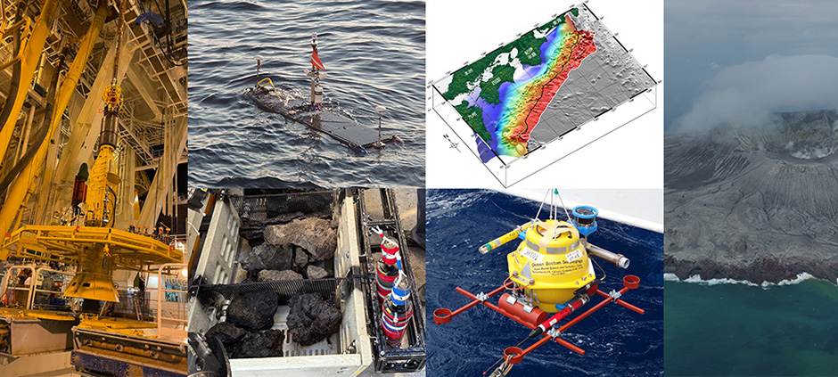
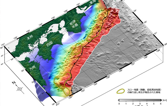
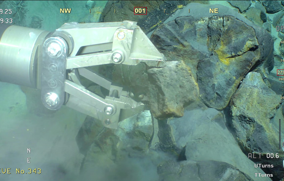
To understand and reduce the impact of earthquakes, volcanic eruptions, and tsunami disasters along the subduction zones of Japan, we conduct comprehensive research that encompasses not only surface phenomena but also deep Earth processes such as energy transfer and material circulation that drive plate motion.
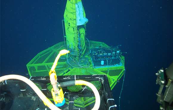
In collaboration with national agencies and universities, we carry out seafloor surveys and observations around Japan and the Pacific Rim using research vessels and advanced observation systems.
We are also developing analytical methods based on real-time monitoring technologies and subsurface structural models to understand ongoing seismic, volcanic, and tsunami activities.
By integrating and analyzing observational data, we aim to provide scientific information to relevant national bodies, including the Headquarters for Earthquake and Volcano Research Promotion, thereby supporting disaster prevention and mitigation measures of the government and local authorities.
| Address | 237-0061 2-15, Natsushima-cho, Yokosuka, Kanagawa, 237-0061, Japan |
|---|---|
| Web site, SNS | https://www.jamstec.go.jp/e/ |
Sanyo Trading/Picarro
Sanyo Trading/Picarro
Contents
Contents
Download
Contents
①× ×, 2021(×)13:00~14:00
②× ×, 2021(×)13:00~14:00
Please click here to contact us (Zoom will start)
SGS Beta
SGS Beta

Fast delivery guaranteed (3-14 business days)
Meet your deadlines without fail
Consistent accuracy
Peace of mind when there is no room for error
ISO/IEC 17025:2017 accredited results
Unquestionable data for high-end publication
Expert technical support
Analyze only the most suitable samples to optimize your budget
Secure online portal
Access your results anytime from anywhere
Biomedical samples not accepted to prevent cross-contamination
Contents
Download
Contents
①× ×, 2021(×)13:00~14:00
②× ×, 2021(×)13:00~14:00
Please click here to contact us (Zoom will start)
| Address | 4680007 4985 S.W. 74th Court Miami, FL, USA 33155 |
|---|---|
| Web site, SNS | https://www.radiocarbon.com/ |
Tokyo Geographical Society
Tokyo Geographical Society
The Tokyo Geographical Society (TGS) founded in 1879 is a long-established Japanese academic society. In 2025, its membership totaled ca. 650 professionals, comprising scientists, teachers, and engineers, active in fields including geology, mineralogy, geography, geophysics, and geochemistry. The founding concept of TGS is to contribute to the advancement of the geosciences over a wide range of related fields encompassing the natural and social sciences, humanities, and engineering, and to promote the public dissemination of research results in the geosciences.
Although we have no regular meetings for presenting research papers as usual academic societies, we have continued to carry out a wide range of activities as below:
1. Enhancing public awareness on geosciences
1) Scientific lectures, excursion and geotours
2) Collecting books and literature related to geosciences and compiling the history of geosciences
3) Introduction of geo-experts among the society members to the public as lecturers, committee members, geotour guides, etc.
4) Cooperation and contact with related academic societies
5) Publicity activities through website
2. Publishing and distribution of geoscience journals and publications1) Editing and publishing the official journal: Journal of Geography (Chigaku Zasshi)
2) Distribution and selling publications of the society
3. Grant and award programs for researches and outreach activities
1) Grants for geoscience researches, international geoscience meetings, and outreach activities and publications
2) Awards for individuals and groups within Japan and abroad, who are significantly contributing to the development and dissemination of geoscience.
TGS Website
Soon after the Meiji Restoration in 1868, four diplomatic and cultural envoys-statesmen and scholars Hiromoto Watanabe (1848–1901), Takeaki Enomoto (1836–1908), Naohiro Nabeshima (1846–1921), and Moriyoshi Nagaoka (1842–1906)-were dispatched on missions to countries in West Europe and Russia. They all came to realize the important roles the geosciences played in the development of these advanced nations. Having joined Royal Geographical Societies in Vienna,
London, and St. Petersburg during their stays in Europe, and they felt there was a strong need to establish a similar society in Japan. Upon returning to Japan, they founded the Tokyo Geographical Society on April 18, 1879. Modeled after the Geographical Society of London (the Royal Geographical Society), its purpose was to contribute to the modernization of Japan. Imperial Prince Yoshihisa Kitashirakawa (1847–1895) accepted an invitation to be the first president.
The publication of TGS at the time of its founding, the Report of the Tokyo Geographical Society, was succeeded by the Journal of Geography (Chigaku Zasshi), which was first issued in 1889. Six issues a year volume, the latest issues and editorial and submission guides, can be accessed at the journal website of TGS. All issues and papers since 1889 are archived on J-STAGE. The number of papers downloaded each month in recent years has exceeded tens of thousands, indicating the high degree of recognition our official journal.
Special issues on themes of particular interest to geoscientists, focus mainly on the Japanese archipelago and the Asian region as a whole. Distinguished geoscientists engaged in a wide range of fields provide valuable review papers summarizing the frontiers of their research. Published in color, examples of recent issues are shown below:
Journal Archive
Open scientific lectures are held regularly in spring and autumn. Geo-experts give easy-to-understand explanations on topics of broad interest to the general public, such as natural hazards, climate change, and natural resources, as well as interdisciplinary issues. Announcements, abstracts, reports, and materials related to the lectures are available on TGS website (Lectures and Geoscience Club) and in Journal of Geography to provide records of our activities.
Geoscience Club is a few times a year lecture event designed to promote the geosciences, as well as to serve a social function for members and guests. Geoscientists engaged in first-rate research are invited to present state-of-the-art research results in a relaxed, salon-like atmosphere at the auditorium of the Chigaku Kaikan (in central Tokyo). This series of lecture events has been held since 1961.
The Society conducts geo-tours and field trips once or twice a year in Japan for the Society members and the general public.
Information and reports on the geotours and field trips are posted on TGS website (Geotours and Field Trips) and in Journal of Geography.
In 2026, map lectures and geotours will be held for 8/18, 10/18, and 11/15.
Since 1983, we have continued the grant system for members and those introduced by our members.
1) Grants for geoscience surveys and research for up to 10 projects a year, a maximum of ¥500,000 for one year and ¥2,000,000 for two years
2) Grants for holding international research geoscience meetings in Japan, for one to three projects a year, up to ¥1,000,000 per project
3) Grants for publication activities to promote an understanding of various geoscience phenomena in general and to raise awareness of the geosciences in areas related to geoparks and natural heritage sites in Japan, for one to two projects a year, a maximum of ¥1,000,000 per project
4) Grants for outreach activities to promote an understanding of various geoscience and geography club in high schools, for one to two projects a year, a maximum of ¥150,000 per project
5) Grants for outreach activities to promote an understanding of various geoscience and geography education in high schools, for one to two projects a year, a maximum of ¥200,000 per project since 2024
6) Emergency Research and Survey Grants 2024 and 2025 for Noto Peninsula Earthquake of 2024 and subsequent disasters, and their reconstruction assistance for a few projects a year, a maximum of ¥1,000,000 per project
Guidelines are posted on TGS website (Grants and Awards) before the application period every year, and a list of grants awarded is also available.
The Society honors individuals and groups both in Japan and overseas who contribute significantly to the development and dissemination of the geosciences with two awards: the Medal of the Tokyo Geographical Society and the Distinguished Service Award for Geoscience Dissemination.
A list of award recipients is available on TGS website (Grant and Award).
We welcome people engaged in research, education, or work related to the geosciences, as well as those interested in the geosciences in general, to join our society (annual membership fee: ¥5,000).
For details on membership, please consult our website (Membership).
| Address | 102-0084 12-2, Nibancho, Chiyoda-ku, Tokyo |
|---|---|
| TEL | 03-3261-0809 |
| FAX | 03-3263-0257 |
| Web site, SNS | https://www.geog.or.jp/english/ |
Tokyo Sokushin nanometrics
Tokyo Sokushin nanometrics
Contents
Contents
Download
Contents
①× ×, 2021(×)13:00~14:00
②× ×, 2021(×)13:00~14:00
Please click here to contact us (Zoom will start)